|
|
Post by danzig70 on Mar 13, 2012 1:07:33 GMT 1
No problem, I am sure you are busy. I dont think the sav games need to automatically loaded as those can be launched by shortcut. It looks like I wont be traveling so I should have time for it.
|
|
|
|
Post by Major Pain on Mar 16, 2012 13:56:26 GMT 1
Danzig
I haven't forgotten... I am still in the process of reloading backup files after preparing temp computer.
|
|
|
|
Post by danzig70 on Mar 17, 2012 0:18:54 GMT 1
No rush at all. I will be going to Moscow and St. Petersburg but not Barnoul so I will be gone after next week for a while. I have just been working on the first map and I had forgotton how fun map making is. I hope to finish the landscape, buildings, map zones and simple map script before I go on the 23rd. The map starts in Forbach but then you have to drive through that map and then another before getting to the front line (border). Is that stupid? I dont know if people want to just jump into the action especially if it returns to the chapter screen after each map.
I also thinking of a different approach. I can open each map initially and save each one as mapname.sav. The player's units wouldn't have landed yet. If the chapter script houses the global variables for where the core unit is and from which direction it is entering the next map, then the map scripts can check the status of those variables when you start them. For instance, the chapter starts in Forbach. I can click on something and start the Saarbrucken map but the map script reads the chapter global variable and doesnt land any reinforcements. This way you can get "some intel" on what you will be facing but won't be able to select anything except perhaps recon planes. I'm working on the user interface part now also. There will have to be icons of some kind for players to launch the saved games and I am unsure how exactly that would look, but it may represent the objective for that map such as a bridge symbol, depot symbol, etc.
The nice thing with the interface is that I have had some succcess with embedding a flat map in a web page like my site and the sites I posted previously. The advantage is that javascript functions can write the hyperlink targets on the fly and indepth tactical information can be displayed on the map. The disadvantage is that it's flat:)
|
|
|
|
Post by redvlastelin on Mar 17, 2012 6:08:00 GMT 1
danzig70, i think that you should not doubt. Go as they say in Russia "by ways of trial and error". ;D The only way you will come to a better solution.
|
|
|
|
Post by danzig70 on Apr 17, 2012 19:50:31 GMT 1
Thanks red. I use alot of trial and error  I have updated my page to make it look a little bit more like a webpage. The link is in my signature. I still have alot left to do on it though and will update often. I have the OA mod and Italian Units mod to add but should add them this week. Im still working on my Saar chapter but map making is sooo slow. Havent even started on the script yet. UPDATE: The webpage is not yet ready for prime time but I have made some progress with the layout. I still have to rework the BKTopo program and make two campaigns, but it's a start. |
|
|
|
Post by danzig70 on Jul 19, 2012 3:57:38 GMT 1
Made some more progress with the layout of the webpage. I figure I'll use the website as a campaign map and then use WorldWind, Google Earth or ArcGIS Explorer as more of a tactical map.
I also thought it would be neat to show fraps videos of battles that people could upload but I have to figure out how to set up my webpage for that.
Well, unfortunately, I just won't have time.
|
|
|
|
Post by danzig70 on Jul 20, 2012 20:25:29 GMT 1
I think I have found the formula for calculating the shading for heights associated with hills on a map. edndoc.esri.com/arcobjects/9.2/net/shared/geoprocessing/spatial_analyst_tools/how_hillshade_works.htm The method appears to be basically the same as the height brush in the map editor is similar to the "computing slope and aspect" diagram. Can anyone tell me the angle or position of the light source that is used in the BK perspective view? I have tangram's building tutorial and believe the angle would be used to create building shadows. The maps I have created have accurate heights but the shading is all wrong. Any help is appreciated. |
|
kaoz
General
 inter faesces et urinam nascimur
Posts: 1,112
|
Post by kaoz on Aug 5, 2012 0:19:00 GMT 1
Light position is north-east, but i couldn't say the exact angle, although i guess it to be high (like noon) because the shadows are never really big (like if the sun would be on its highest point)... Good luck!
|
|
|
|
Post by danzig70 on Aug 8, 2012 17:16:29 GMT 1
Thanks Kaoz. Im going to try a few values and see what works best. The shaded value is 208 for flat terrain so I'll know when I have it right. UPDATE: I ran a test with values from the example on the hill shade website and arrived at the correct shade value! So I know that my formulas are right. It uses the illumination angle of 45 degrees, with 0 being at the horizon and 90 being at zenith or noon - directly overhead. That makes sense. It uses the direction of the light source, azimuth, of 315 degrees. I may have to tinker with that value. It's a bit confusing since the game view is in perspective view. Here's a good graphic where the star point would be the light source and the altitude is expressed as the illumination angle:  UPDATE: Well I got the program to work and applied the shade values but it made no difference at all. Oh well. Here's a test map (xml) with the height and shade values if someone wants to load it into the Map Editor and take a look. www.danreavey.net/files/test.zipI am hoping that different textures will help to give the impression of heights and flat areas. This is what it should look like: 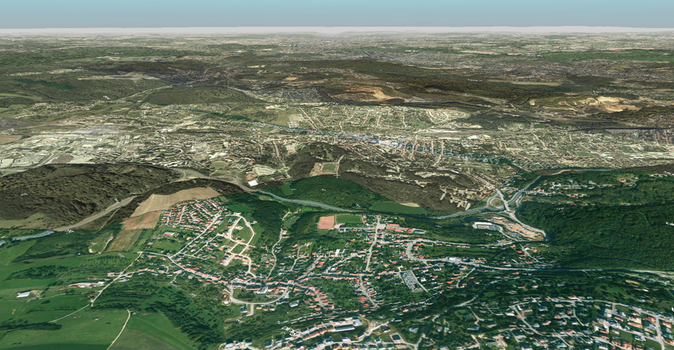 |
|
|
|
Post by danzig70 on Dec 26, 2012 2:43:47 GMT 1
I am back working on this project. I have done as much as I could with the terrain and am having a try at making buildings. I found some good photographs of Forbach, France and am going through some youtube video tutorials for making buildings. I think the texturing will be the toughest though. Here is a WIP of the L'église St Rémy in Forbach: 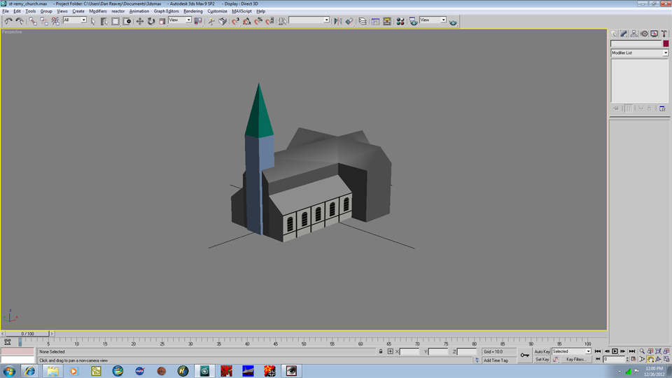 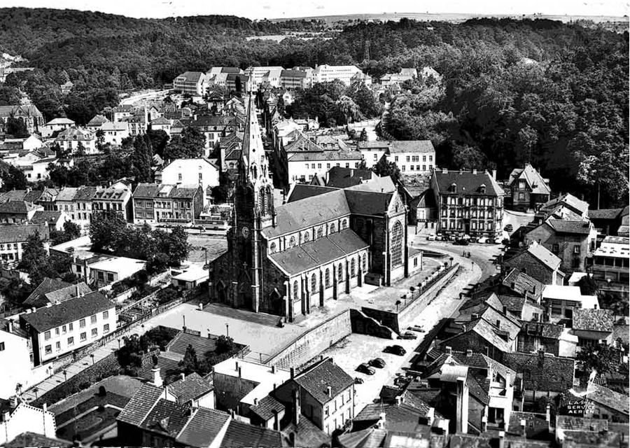 After the buildings, I will work on the scripting for movement between maps. |
|
Folgore
General
 (Once) BK Translator
Posts: 1,431 
|
Post by Folgore on Dec 26, 2012 23:55:27 GMT 1
Well, well, well, maybe the new year will bring us something...  |
|
|
|
Post by danzig70 on Dec 28, 2012 18:40:45 GMT 1
Well I hope so, Folgore..it'll be three years pretty soon! I am having some trouble with texturing the model. Some textures fit on the polygons fine, but others get distorted. Very strange. This is what Ive been able to do so far: 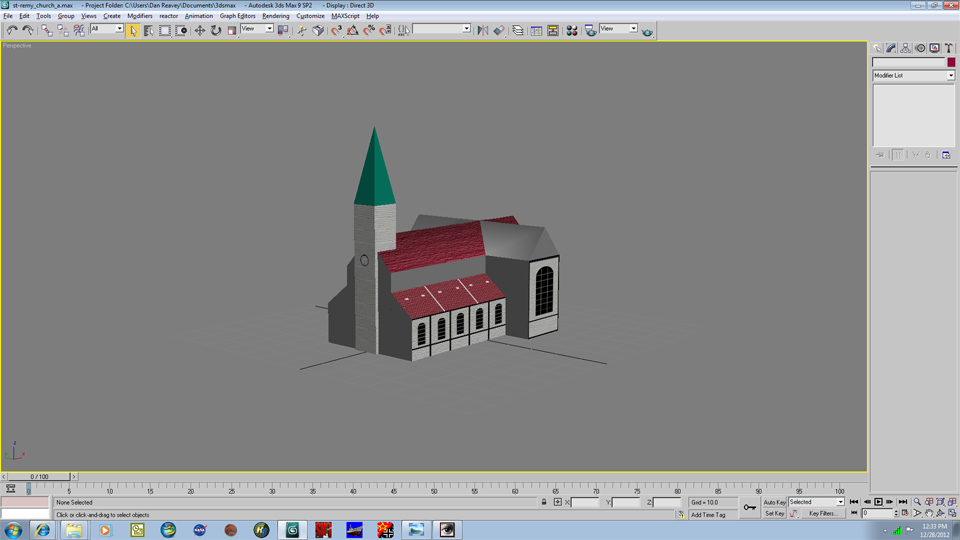 |
|
Folgore
General
 (Once) BK Translator
Posts: 1,431 
|
Post by Folgore on Dec 29, 2012 0:32:08 GMT 1
Ask vonosten. He's very good on textures  |
|
|
|
Post by danzig70 on Dec 29, 2012 3:03:08 GMT 1
Yep, that's what I was thinking. He has done some great buildings. I'll send a message.
|
|
|
|
Post by danzig70 on Jan 17, 2013 21:21:46 GMT 1
I had to start over as I screwed up the textures/materials a bit. I have done a bit more detail and hope to have better luck with the textures this time. 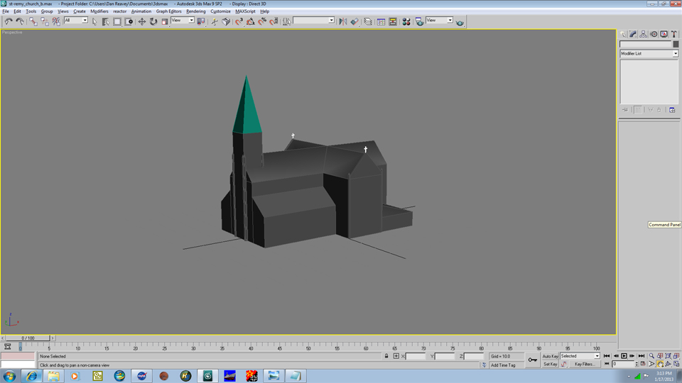 |
|