Zero
Porucnik

Posts: 167 
|
Post by Zero on Jan 17, 2014 20:24:47 GMT 1
Another part of the town, work in progress as far as backyards concerns and some minor adjustments; 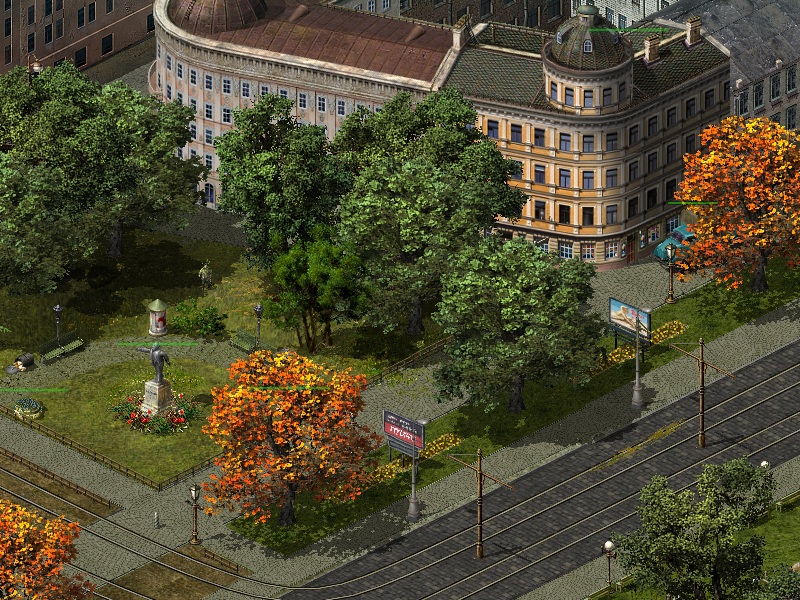 Haven't been able to get my old map working after doing some changes to my game files - or to be honest, haven't had the time to check properly, but thanks to my screens from that map I'm in the process of recreating some of those spots in this new map; 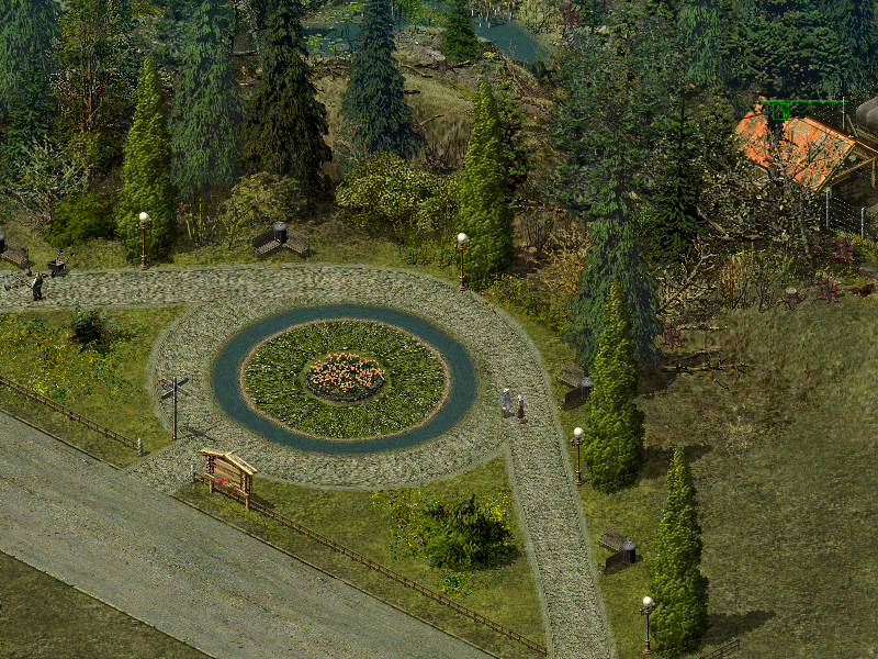 Not a 100% accuracy indeed as the surroundings may differ, but still...  |
|
|
|
Post by Quintaxel on Jan 17, 2014 21:06:53 GMT 1
Nice screenshots (again). Do you have an overall layout planned for your map or are you building as you go along ?
|
|
Zero
Porucnik

Posts: 167 
|
Post by Zero on Jan 17, 2014 21:22:03 GMT 1
I don't bother to much with any initial ideas as I constantly find myself changing and adding as I go along. Much more fun that way really I think!  Admittedly some of you may find that map making for me takes a lot longer than for the average map maker, (just a guess), but it needs to be taken into consideration that it's a huge difference creating a town map than a country side map seeing all the details that makes up for a town - and to me details are essential for the overall experience. I just don't like throwing out a building here and there, adding a couple of trees and place roads or rails that in real life would mean that the hospitals would be overloaded with injured people from car/train accidents happening all the time. It's a question about aestethics in my point of view...  And speaking of the latter, I remember from the last time I played the game that there was a problem with one of the bridges; 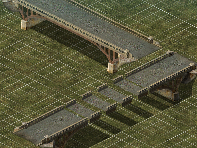 As you can see the west-east direction is fine, it's the south-north that has some issues! Has this bridge been updated, and if so, where can I find it? |
|
|
|
Post by Quintaxel on Jan 17, 2014 22:04:46 GMT 1
Zero, the reason I asked if you have a layout in mind is because personally I find the layout of a map one of the most difficult things of making a map. I'm not much of mapper but I also used to made my maps the way you do. I called it the "Sim-City" approach  . You start with a road, a couple of buildings and continue from there. I remember how much time it took to come to map that was satisfactory to me. However, I learned afterwards that it was difficult to create a game scenario for those maps. Of course it depends on where you want to go with your map. Just sharing my experience here. Anyway, the most important thing is that you enjoy making your maps. I for one enjoy watching your map developing. Keep on mapping ! |
|
Zero
Porucnik

Posts: 167 
|
Post by Zero on Jan 17, 2014 22:26:50 GMT 1
I'd say I do it similar to your approach, start with a block and some roads and then I go from there. Problem is I usually work on different projects on a map at the same time, going back and forth, adding, removing, improving - or even a complete change when noticing after going back a few times, that it didn't turn out as good as I hoped for. And on top of that I try to construct all these natural obstacles you can find in towns with bridges, dense blocks, water and what not. I understand that adding a scenario to this particular map may not be that easy - which is why I'll leave that up to anyone with those skills. I'm not a scripter, I'm a builder...  And I do have several maps planned for - and for every climate. Besides, not every map I'm creating will take as long as this one, seeing as country side maps are much easier to create, but with that said I do intend to create some particularly interesting maps also for a winter scenarios as well as the desert ones. And as mentioned for this town map I do have a scenario in mind; It's mainly held by the Germans, but awaiting reinforcements they had no other choice than to retreat back to the main base upnorth, (where I have a big complex in mind), having the information that the allies is on their way. So basically the allies enter the town with very little resistance despite its size and importance and all is well. But the one and only bridge leading to the German base is heavily guarded and it's a difficult task to even get close to it. And the allies will find themselves under attack from German air forces almost immediately as they enter the town, indicating that new German reinforcements are arriving on a continuous basis for as long as their base upnorth is kept intact.I believe it won't be easy to maneuver tanks and the sort in town with all the obstacles, and especially when trying to avoid the air raides that will come in waves, but isn't that the way it works/worked?  |
|
Zero
Porucnik

Posts: 167 
|
Post by Zero on Jan 18, 2014 2:27:53 GMT 1
Thought I should show you a bit of an illusion. I've always disliked the fact that it's not possible to pass beneath bridges in BK, and on top of that it's a bit unreal when approaching a bridge when everything is quite flat. Well, since we cannot go beneath them I figured some tricks with road textures and leaning grounds before and after the bridge would do the trick - at least visually and to some extent also more realistic; 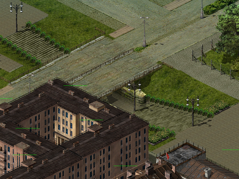 This is the bridge between the town square to the east and the railroad station on the other side to the west, (left side of the picture). The stairs on both sides of the bridge are leaning downhill - or uphill if you prefer depending on the direction - but once under the bridge the height is 0.00 again, otherwise anything passing on the bridge will go downhill and then uphill again where the illusion of an underpass is. The road texture however pretty much indicates that there's pedestrian walkway beneath the bridge, and since nothing can pass under a bridge, anything coming close will of course use the bridge instead. Similiarily, if going down the stairs only to find it's not possible, (as some trucks and tanks do at times), they'll try tyo reach the bridge instead, and by doing so - using the grass sidings, it'll also look more real since these are in fact leaning uphill, (or downhill) towards the peedstrian walkway. If you get what I'm trying to explain...  Oh well...  Edited to add; Edited to add;Forgot to add the comparison image with gridlines on; 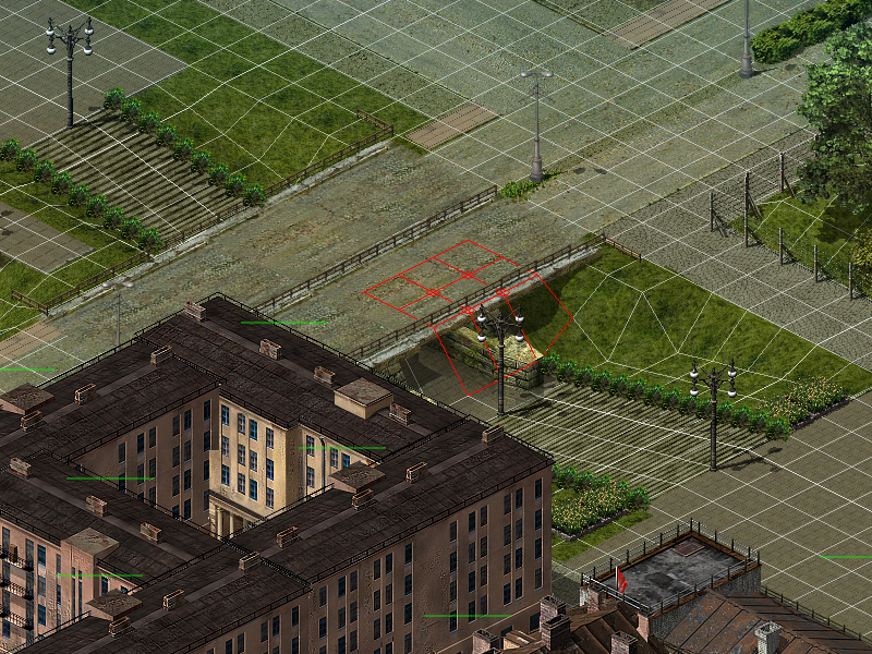 |
|
Zero
Porucnik

Posts: 167 
|
Post by Zero on Jan 18, 2014 12:24:43 GMT 1
Canal Market Day... everything on sale...  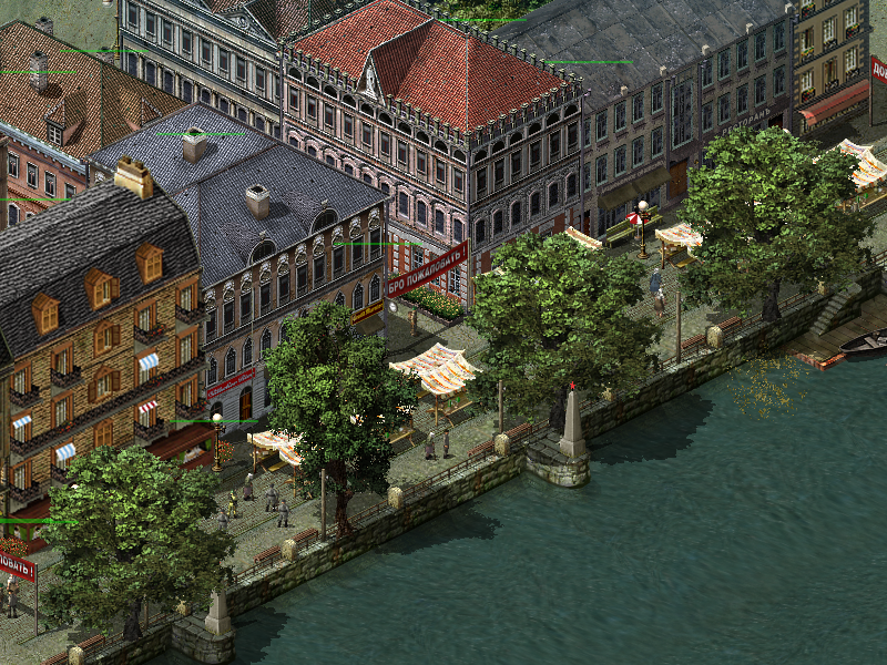 |
|
Zero
Porucnik

Posts: 167 
|
Post by Zero on Jan 18, 2014 19:41:00 GMT 1
The main German base north of the town... Work in progress though, and as expected by a castle like this, it's located on a higher level; 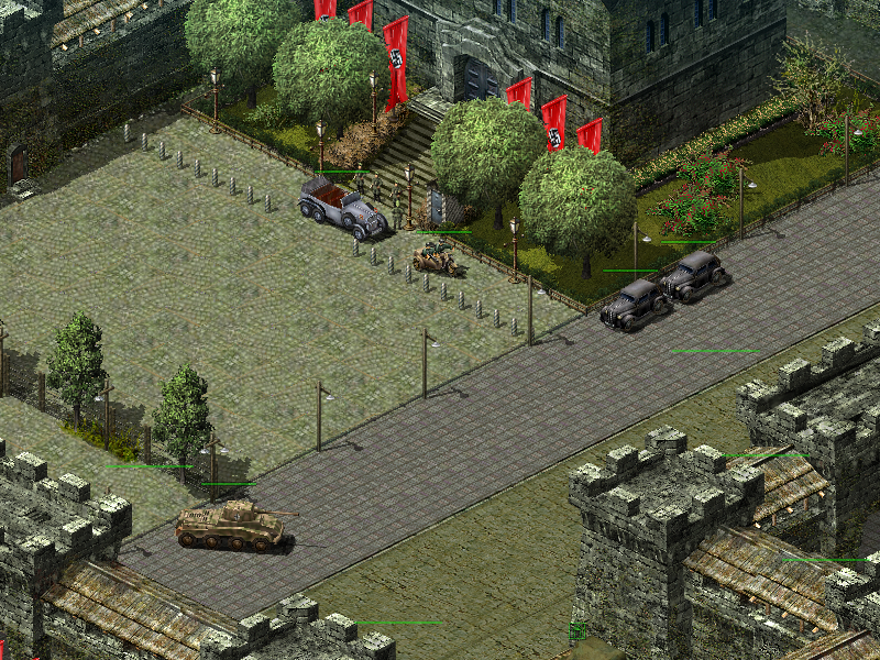 |
|
Zero
Porucnik

Posts: 167 
|
Post by Zero on Jan 18, 2014 23:02:09 GMT 1
Here's how I imagine the defenses of the German base; 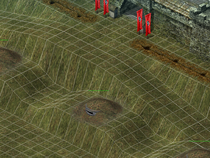 It's also surrounded by water and only accessible through one road bridge, albeit a second bridge for the main railway line is located on the right side of the castle walls... |
|
|
|
Post by Stanenberg on Jan 18, 2014 23:24:08 GMT 1
impressive work with hills. I wonder how you are doing this...
|
|
Zero
Porucnik

Posts: 167 
|
Post by Zero on Jan 19, 2014 0:00:10 GMT 1
impressive work with hills. I wonder how you are doing this... Thanks, but it's not as difficult as it may look like. But a steady hand, an equal percentage of levelling for a perfect result, and a constant map update to keep the mouse sync'ed...  Here are some "before" screens of the place before I start "dressing" it up with surroundings and everything else. Another little trick that can be useful if you want vechicles to chose a specific path - especially in areas like this high up located castle - is to use a thin line of water. As can tell we want the tanks to go from the castle entrance downhill to the harbour, (not yet there), and we don't want it to take a shortcut down those steep hillsides. Apart from it being very unrealistic it also looks hilarious. But if you take a closer look at the screen you can see the thin line of water along the sides of the roadway going downhill. This neat trick will ensure that the tanks won't take any other way down at all!  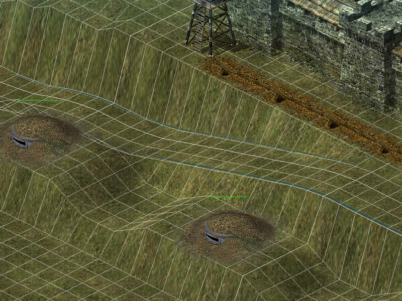 The eastern part of the castle; 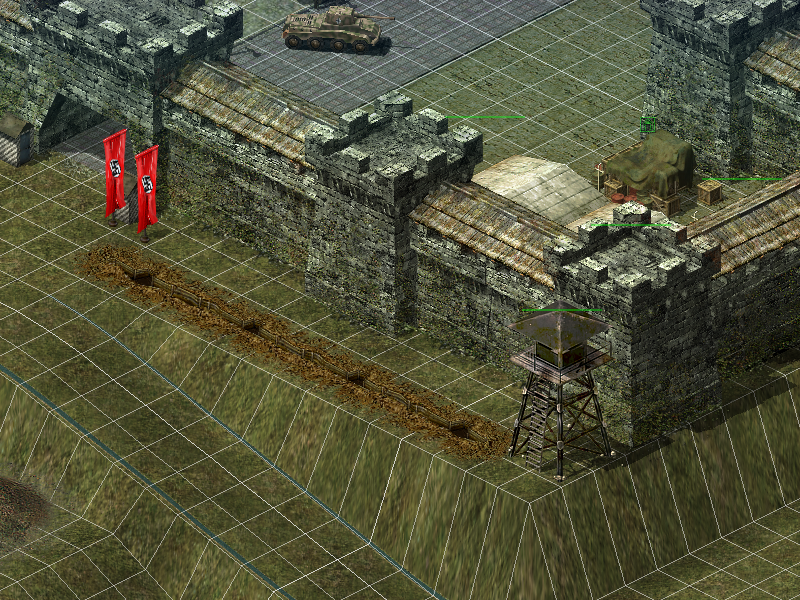 And the east gate which leads down to the railway tracks, (also not there yet); 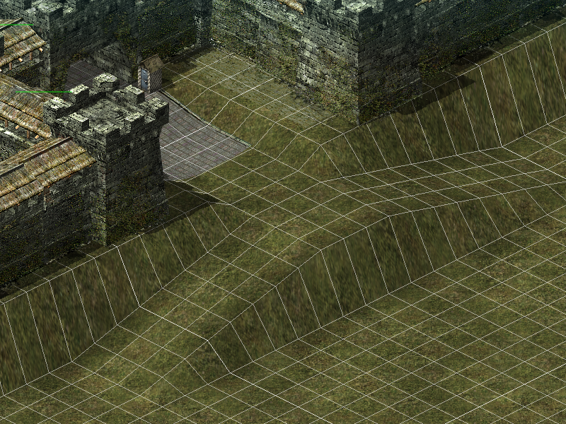 And the railway area to be built. It goes uphill even for the railway after leaving the bridge crossing the sea between the town and the castle, but for railroads it's important not to make the uphill/downhill too steep. I usually go with a 25% levelling, (0.25), for roads and a 10% for railroads with a soft levelling where uphill/downhill meets flat ground. This makes it look even more realistic; 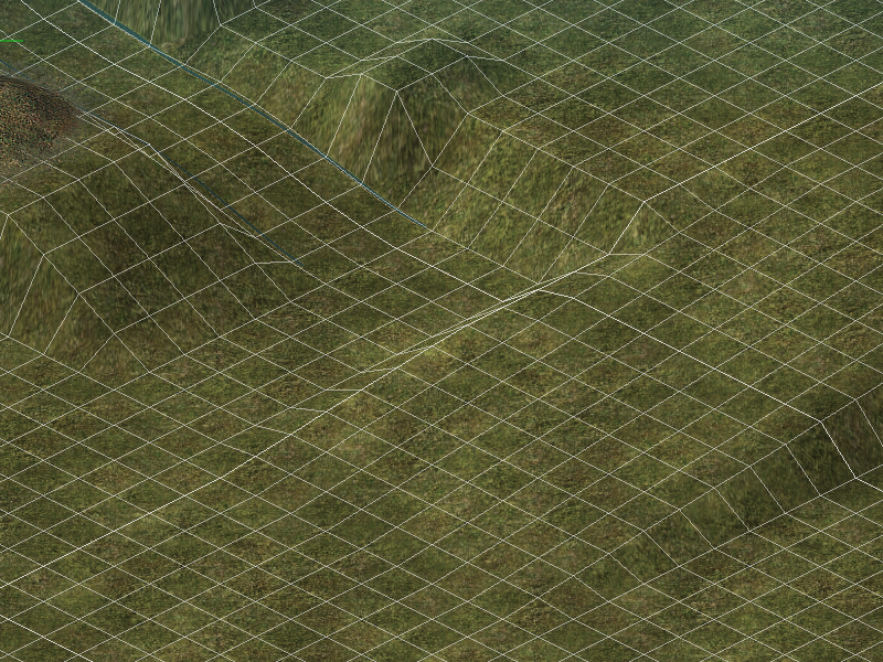 |
|
|
|
Post by Quintaxel on Jan 19, 2014 10:30:45 GMT 1
Using these rivers to make certain areas of the map impassable is a neat trick. You could probably mod a path so it has the properties of a river, no ?
The way you create elevations, I still don't get it. I hope that one day you'll make a step-by-step guide for dummies like myself.
|
|
Zero
Porucnik

Posts: 167 
|
Post by Zero on Jan 19, 2014 11:47:04 GMT 1
Using these rivers to make certain areas of the map impassable is a neat trick. You could probably mod a path so it has the properties of a river, no ? The way you create elevations, I still don't get it. I hope that one day you'll make a step-by-step guide for dummies like myself. I have no idea if it's possible to make a mod with the properties of a river, but it would certainly come in handy - especially if appearing as a tiny ditch or something that'll work regardless of what's close to it. Good idea actually!  As for creating elevations, if I'll get some spare time in the future I'll see if I can produce a guide for it - although I insist it's a lot easier than it may look like. One of the keys is to ensure that the height speed is at 1.00 so you can elevate the tile slowly up or down, and you simply raise it or lower it a bit and release the mouse button to check the level height itself, (unfortunately it doesn't show while elevating). If it's to high or to low than what you had in mind, all there's to it is to gently raise or lower a tiny notch to get the desired height level. I usually elevate a large portion of the area while working on it so it's easier to correct mistakes and to have some workspace for uphill or downhill elevations, (such as roads and rails). However, it gets a bit tricky when reaching higher elevations, but again, using a wider workspace makes it a lot easier. Another key to pay attention to are shadows - and in particular on the north and the west side. This means that it's not wise to make steep edges facing any of those directions. If you have a closer look at the images above you can see that I have made the steeps rather huge on the tiles that faces the south and east direction, and that's perfectly fine. Doing the same thing on the north or the west side will add a blackish line for the shadows, which doesn't look good - obviously. To avoid this, always ensure that the lines on each tile facing the north or the west direction never goes beneath the upper tile. I'd say that the maxium level ration for the two latter directions shouldn't exceed 0.50. |
|
Zero
Porucnik

Posts: 167 
|
Post by Zero on Jan 19, 2014 19:23:14 GMT 1
A quick question about the rules of roads and rivers at the end of a map; How far outside the edges can I place a road or a river without facing issues, and at the same time make it appear as a road or a river continues outside a map? Thanks in advance for any quick answer!  Also, any more information available as far as that bridge concerns I brought up a few day ago? |
|
|
|
Post by ariete on Jan 19, 2014 19:52:21 GMT 1
A quick question about the rules of roads and rivers at the end of a map; How far outside the edges can I place a road or a river without facing issues, and at the same time make it appear as a road or a river continues outside a map? extend the last poit until you can, outside the edges, this is usefull when terrain near edges have irregularity and the road is enough long to cover the terrain raised and so extended |
|