|
|
Post by danzig70 on May 14, 2011 0:37:20 GMT 1
Nice! I had a windup radio that worked great.
Just got my tax refund so I may have things up and running in a few months! The benefit of being overtaxed all year long.
|
|
|
|
Post by danzig70 on May 28, 2011 22:17:45 GMT 1
I have setup my workstation computer. It doesnt have a graphic card slot but I can work on the map generator program. The program works off an elevation file and will come with plenty of files I have already downloaded. The ideal elevation file will cover a 1 degree x 1 degree area. Since the area is so big the number of BK maps of uniform size that can be made is 3600 which is a bit excessive.  So I am making a little sub-interface that overlays BK maps onto the image of the elevation file. The blue and red squares represent friendly and enemy unit positions at that particular time. This is already input by the user or preset. You fill the squares with a specific green color and the program will just select the data for that area. This way you can plan your moves or anticipate AI moves and generate maps for those areas. The rivers are clearly visible and I may add topo and other image layers so road, rail, city features are also shown. It will probably also create the topomap.tga file for the BK map editor. 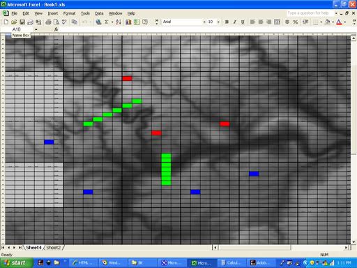 Maps do not have to be adjoining; you can just select single cells and as many or as few as you want. I wont be able to test the maps so I may need a volunteer to load a generated map into the editor. Here are some screenshots how I assign elevation values for each BK map tile. Its based on a 20x20 sized map. Download the data 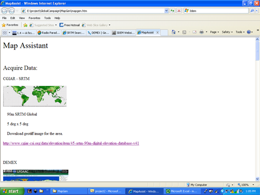 Open an existing file or search based on city or coordinates input by user. 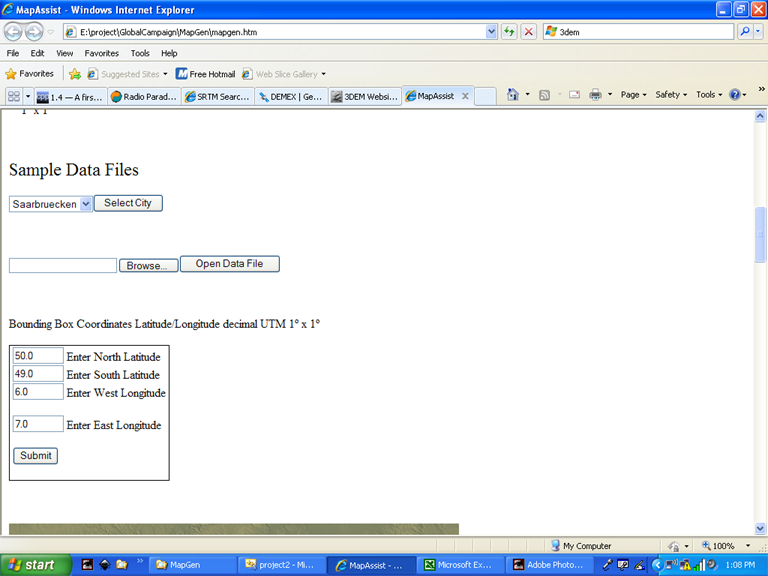 Which sets the background image for the map sector. 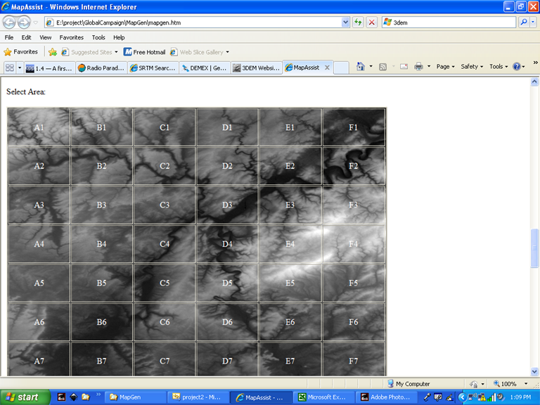 Clicking on a cell above sets the background image for the BK map sector. 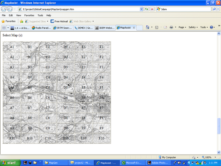 The coordinates of each cell is already known so the program reads the data file for the rows and columns of the area selected. I needed to work everything out visually first so I made a spreadsheet. These tables assigns long/lat for each cell in the tables above. 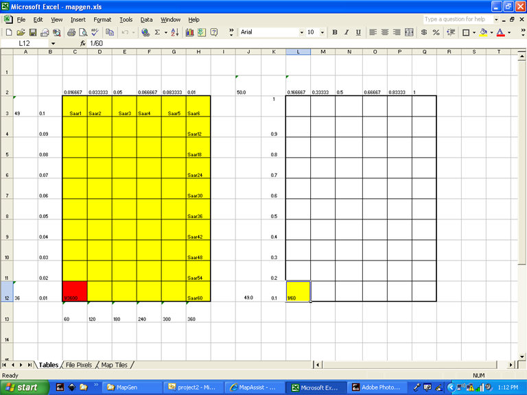 There are only 36 rows and 60 columns of elevation data pixels. 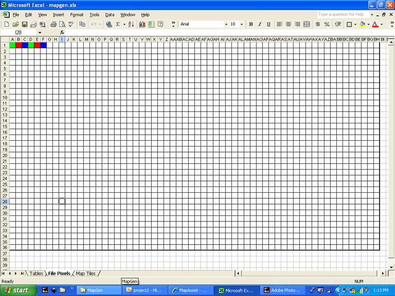 To make a square map each original pixel creates a tile 3 pixels wide x 5 pixels high. 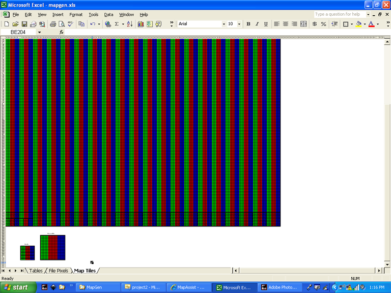 But this creates a 180 x 180 size map which is too small. A 20x20 map is 320 tiles x 320 tiles. So, since 180/9 = 20, I divided the cells into blocks of 9. These are then converted to BK tiles which are in groups of 16. The process is below. 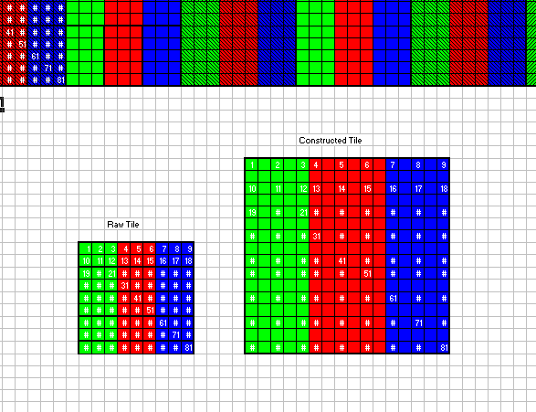 The program creates the map by editing a blank 20x20 template map such as desert, summer or winter, reading the table value and replacing the existing values in the file. To that end, I am learning some c++  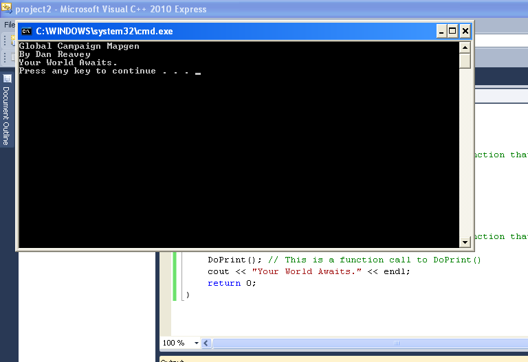 |
|
Xmen
Pukovnik

Posts: 373
|
Post by Xmen on Jul 7, 2011 19:11:52 GMT 1
Any News about this "MAGIC" tool?
|
|
|
|
Post by danzig70 on Jul 7, 2011 22:47:15 GMT 1
I wish it were magic!
I am still doing c++ tutorials but have taken a break for a bit. I got mentally exhausted from having to learn one thing after another. I still need parts for my new computer so I wouldnt be able to test it even if I created the file.
I am still hoping to have a demo file done by the end of this summer.
|
|
Xmen
Pukovnik

Posts: 373
|
Post by Xmen on Jul 7, 2011 23:05:00 GMT 1
You have create an XML map?
IF yes, maybe i can test it for you....
|
|
|
|
Post by danzig70 on Jul 8, 2011 1:03:19 GMT 1
Yes, it will be an xml file. That would be great if you could test it.
I will be out of town next week but will try and get something soon.
Thanks!
|
|
kaoz
General
 inter faesces et urinam nascimur
Posts: 1,124
|
Post by kaoz on Jul 8, 2011 3:20:32 GMT 1
wow, Dan, i'm speechless...
|
|
|
|
Post by danzig70 on Jul 8, 2011 16:45:14 GMT 1
 Well this would only do the heights but Im thinking of a way that the user could draw roads, rail and rivers which would end up on the map. Like the Fields Composer (graph composer? I cant remember) on the RMG. The topo map woudl be "underneath" so it should be pretty straight forward. Units are another thing. The French MP team has a way of programmatically adding units to a map. That will be last. Its all part of creating a virtual world. I am also working on an economic sim so have been studying economic statistics. digital.library.northwestern.edu/league/stat.htmlI'll post some images in the near future. |
|
Xmen
Pukovnik

Posts: 373
|
Post by Xmen on Jul 8, 2011 17:56:14 GMT 1
Hep Danzig, i 'm ready to test YOUR MAP  ........I am waiting for you  |
|
|
|
Post by danzig70 on Jul 9, 2011 0:13:53 GMT 1
you might want to sit and have a beer while you wait  I haven't even got to the chapter on arrays yet. Could someone make 20x20 blank xml maps for me? I don't have any archived. I need a spring, summer, winter and africa map to serve as templates that the program will edit depending on time and place. There are over 100,000 tiles in rows of 320 so i have to test where the 321st tile gos. I assume its left to right but that's what tests are for I suppose. I'll be on vacation next week but can grab them upon my return. Thanks! |
|
Xmen
Pukovnik

Posts: 373
|
Post by Xmen on Jul 9, 2011 8:52:03 GMT 1
|
|
|
|
Post by danzig70 on Jul 12, 2011 15:08:05 GMT 1
Thanks Xmen, I will be back home next Monday. Here is the picture of my mother's father who was part of the Alpine Guard. They lived near Milan but I dont know where he was stationed. They left Italy by about 1930.  |
|
Xmen
Pukovnik

Posts: 373
|
Post by Xmen on Jul 12, 2011 16:53:44 GMT 1
It's always funny to see how he was well dressed and proud ... today uniform is far less "class".
|
|
|
|
Post by danzig70 on Jul 14, 2011 15:56:12 GMT 1
The Italian Army is good at two things: Posing for pictures and throwing down their rifles.
Not true of course and a terrible stereotype but I laughed when I heard it.
|
|
|
|
Post by Jagged Steel on Jul 14, 2011 16:29:27 GMT 1
The Italian Army is good at two things: Posing for pictures and throwing down their rifles. Not true of course and a terrible stereotype but I laughed when I heard it. Winston Churchill said on the subject of Italy allying wth Germany in WWII: "It's only fair. We had them on our side in the last war." Bad I know, but ya gotta respect WC's wit. Reminds me of another (bad) stereotype concerning the French army: "French guns for sale: Never used, only dropped once". |
|